Maps
The “Remembrance foothpaths” include various routes that connect Tesero, Stava and the mining area on Mount Prestavèl.
The following image shows the route “Dove Stava una valle” from Tesero to Stava in yellow. It is possible to return to Tesero along the “Via dei planeti” (in white) which leads to the Fiemme Observatory and, continuing along the paved road, to the sports field thus closing a ring for a total of about 8 km.
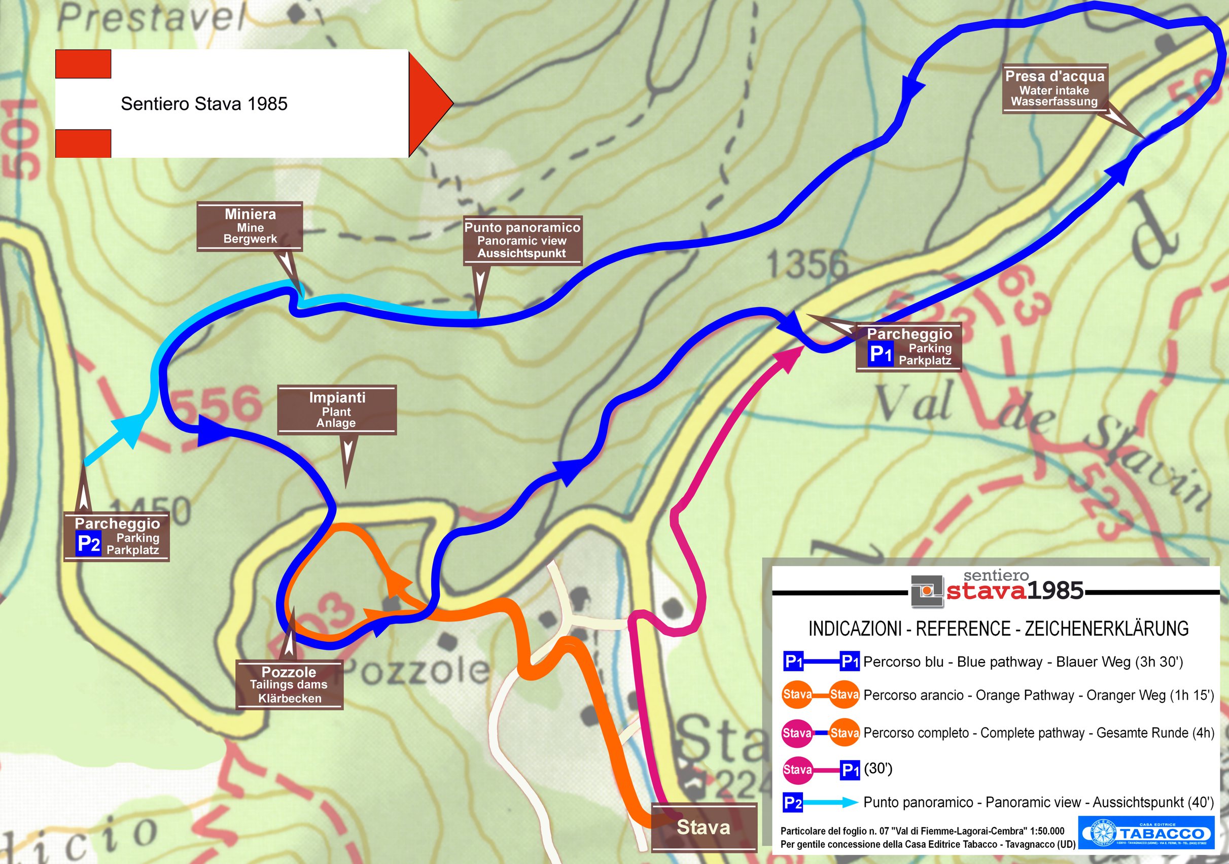
The “Sentiero Stava 1985”, in green, instead leads from the town of Stava to reach the places of mining activity.
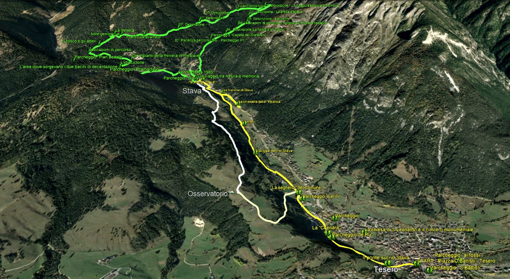
“Dove Stava una valle” pathway – 3,5 Km
“Stava 1985” complete pathway- 8 Km
“Stava 1985” blue pathway – 7 Km
“Stava 1985” orange pathway – 2,5 Km
“Stava 1985” panoramic view path – 2,5 Km